One big aspect of training for trail ultra marathons is getting used to being on your feet for a very long time. With the Bullock Smithy Hike likely to take me somewhere in the region of 12-16 hours, dealing with being on the go for that length of time will be the biggest challenge, with the longest time on my feet race being 9.5 hours so far.
Some other considerations
Being on the go for such a length of time also raises other challenges. What food can I eat that will keep my stomach feeling OK for that amount of time? And what will be navigation be like when the sun goes down?
To be honest it’s the first of these questions which is giving me the most grief. On far too many runs, my stomach has decided to go into an unhappy place. The feeling of bloating to the point of it hurting and the uncomfortable need to find somewhere to, well, sort out that problem. You get the idea. I discovered early on when I used to run road marathons that any more than one gel tended to trigger the nuclear option in my stomach. As I’ve gone for longer and slower off-road races, I’ve moved onto more real foods and these tend to be a lot better for me. I’ll use tailwind in my water to help ensure there’s a steady flow of electrolytes and fuel going into my body. I find this works well for me in the early stages of races where I tend to remember to drink but not necessarily to eat; too often we don’t start eating and drinking until we start feeling hungry or thirsty and by that time we’ve used a lot of our immediate reserves which means we’re already behind on the refuelling task.
The navigation aspect can be tackled in a number of ways. By far the simplest is to have recce’d the route prior to race day so we know what we’re looking for. Coupling that with a side of map-reading and that extra bit of familiarity can take away some of the stress of getting it right on the day. Or night. Because once the sun goes down, the terrain off-road can look very different to how it is in the daytime. Having the confidence that you know where you’re going at night is a big plus to help avoid doing too much going around in circles. It’s a similar (and potentially even more difficult) scenario if the fog / clag comes down as your visual cues are again limited.
Whilst there is now a raft of technology that can help in these circumstances, I quickly learned that they’re useful as a back-up tool, but best not to be relied on as the primary solution. Basically because technology can screw up, or fail entirely. And if that’s all you’ve got, that’s a big problem. Maps on your mobile phone may not load if the signal sucks, but generally a paper map will still unfold regardless of Vodafone’s presence.
Anyway, that’s a circuitous background to today’s post.
Back to the Bullock
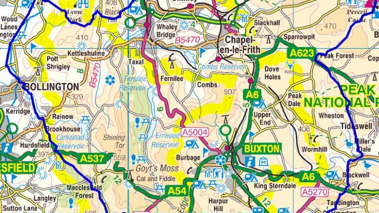
The second half of the Bullock Smithy Hike route is generally accepted as the harder section to navigate. Certainly crossing Brandside is very convoluted with lots of tracks and paths to follow, coupled with the fact it’s very much off the beaten track. And unless you’re running the route quickly, it’s also the section which is tackled during the hours of darkness. With that in mind, a group of us met up at Chelmorton at 9pm last Sunday, to run the second half of the race. At night. Again the theory being that having done it once, there should be less uncertainty on race day.
Of course this made for a logistics challenge as we had to drop a car off there (to get people to our ‘start’) with the knowledge of having to collect it after running to the finish. Not ideal when it’s in the early hours, but due to the remoteness of Chelmorton, there isn’t really any alternative (I think there’s 2 buses a week from Buxton or something!).
6 of us set off from Chelmorton. 4 doing the race in September and the other two coming along for fun. Mad people! I think at different points we’d all run this section in the day time, although only Rob has actually done the Hike in the past. For me it was really to get confirmation in my own mind that I knew where I was going, although I’d previously repeated the Brandside section I’d made a complete mess of.
Here’s the route we took.
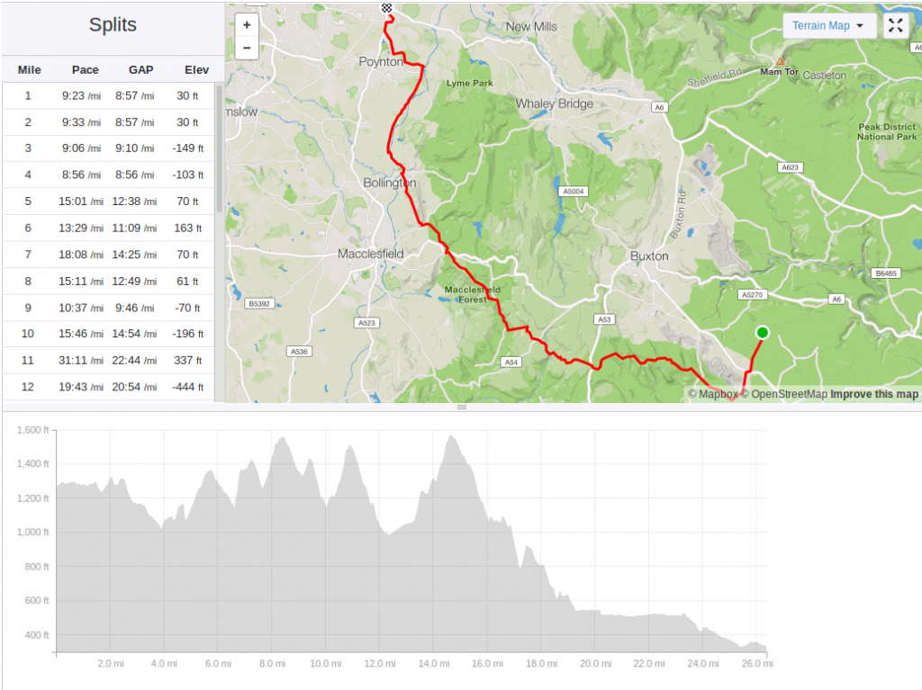
Bullock Smithy Hike recce: 26 miles 2700ft ascent
Of torches and poles
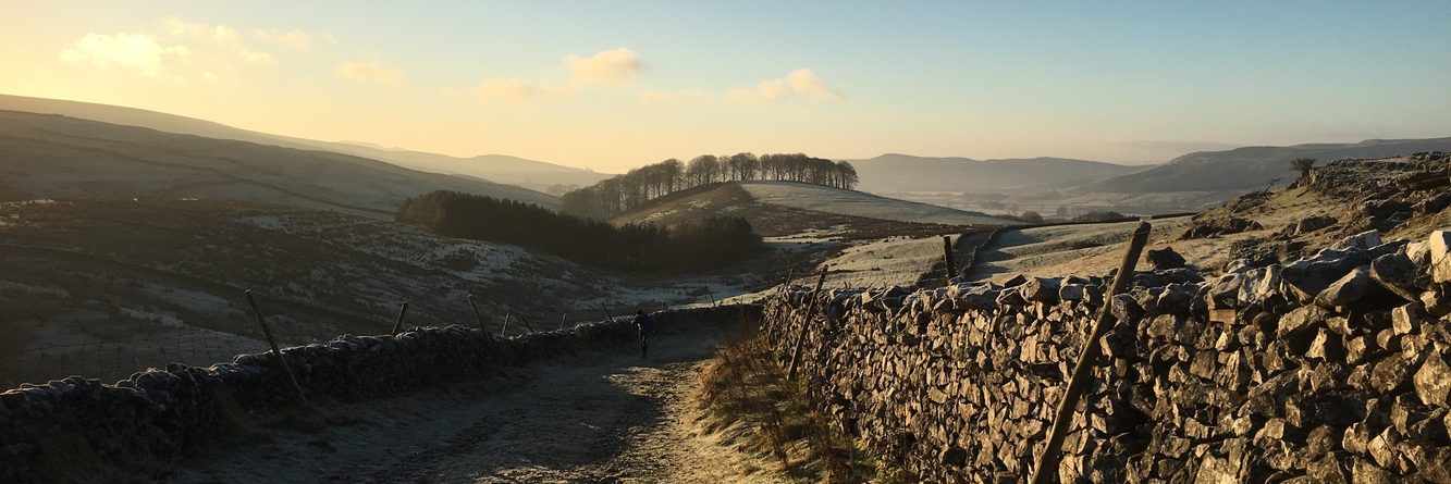
Although it was still light when we set off, by the time we’d passed through Earl Sterndale and reached Stoop Farm, we were relying on head torches. Although there was some light left in the sky, the clouds were building up to the rain forecast around midnight. The fields were quite overgrown and as such the paths quite hard to follow as we approached Brand Top but we managed to find the little footbridge in amongst the reeds and climbed past the aptly nicknamed ‘Scary Farm’ and ‘Scarier Farm’ up to the checkpoint. It’s easy to see how people go horribly wrong through this bit, especially after dark.
I’d brought my running poles with me to try out, having never used them. A couple in the group had used them last weekend at Snowdonia, but for the short distance and technical descent I didn’t think it would have been beneficial for me. It took a while to get used to them but at some point I realised they were just doing their thing and, save for the occasions when I tripped over them, they seemed to work fine!
Runner down
As we crossed through Flash Bar and over towards Three Shires Head the rain started and one member of the group was feeling unwell. Being in the middle of nowhere and, in a valley, phoning for help wasn’t an option immediately so we continued to climb up to the A54 where it was possible to get a signal. However it wasn’t an obvious collection point and even if it was it would have been a long wait, so after discussion we agreed to meet the collecting vehicle at Wildboarclough about 1.5 miles further on. That would be an easier location to meet and would mean that we could keep moving, not that there was much risk of getting cold as it was a warm sticky night, albeit wet. And full of flies. Lots of flies!!!
The section over Cumberland Clough was uneventful and we stopped at the Cottage which is the checkpoint on the race. As we arrived in Wildboarclough, the collecting car arrived and unwell runner was transported away. I don’t think we could have planned the timing any more precisely!
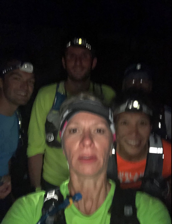
Bullock recce: It’s all a bit Blair Witch Project!
And then there were 5
I will say that my stomach was not i a happy place. I seemed to be full of air for the whole run and, despite a pitstop after Macclesfield Forest, it didn’t really provide much relief beyond the immediate moment. But as I didn’t have a fallback car to collect me, there wasn’t really any option to drop out (whilst I can get a 6 digit grid reference, I suspect the average cabbie probably can’t without a postcode!). We decided to do the Charity Lane route through Macc Forest which is pretty slow going. And ended up with very wet feet as well. I may try the other route option on the day.
Having reached Walker Barn, Rob suggested we tried the ‘official’ route to get to Kerridge. The obvious route is to stay on the main road, but the organisers are keen to keep the Hikers/Runners off road wherever possible as it’s safer being away from the traffic. We tried the ‘official’ route and all quickly agreed that this would be the only time we’d be using it – the road is more direct and just easier under foot. And with fewer flies.
Poles are not the answer to everything
I probably should have stowed the running poles long before this point but my stomach issues coupled with the fact that I’d have to stop to stow them (that’s work in progress) meant I continued with them. Despite the fact they weren’t adding anything and in fact were probably hindering my running, such as it was. The final straw was getting a pole tip stuck in between flag-stones on a path and jolting myself back as a result. But again, this was all part of the learning process of working out when they work and when they really don’t.
The stretch through Bollington was new to me; when I did my recce I turned off the path believing that ahead was private land. As such I joined the canal several miles further back than I needed to. Not a big issue but this route was more direct. And when you’re running 56 miles, every little bit that can help is a godsend! We joined the canal and ran/walk/jogged up until bridge 25 where we reached the Whiteley Green checkpoint. The final stop-off before the end.
Final push
The group decided to remain on the official route which stays on the Middlewood Way until Higher Poynton before heading back via Princes Incline and Towers Road to the finish in Hazel Grove. I guess it’s easier in that there’s nothing to look out for, however I think I’ll go with my original plan of hopping off the MWW early and going cross-country just because the MWW is like groundhog day! We ran the first section but then walked until we got to Higher Poynton. Most of the group were tired. And my stomach just hurt every time I tried to run, so it was less uncomfortable to walk, even if it took longer. By the time we got into the final straight, and knowing I had a 90 minute drive to drop off a runner to their car in Chelmorton, I took a detour via home to drop off most of the kit and to use the loo.
The total distance run was just spy of 26.4 miles and took just over 6 hours. So that’s not too bad given it was almost half of the race itself, especially as I wasn’t feeling 100% for the vast majority of it.
Conclusion
It was a useful run and having the company this time was really nice given it was overnight – I’ve done most of my previous recces solo whilst I worked out where I was going; I find it’s easier that way to ensure I’m learning the route rather than blindly following someone else. I feel relatively confident of getting around the route without getting too lost, but we’ll have to wait until race day to see how that pans out!
Be the first to comment on "Another long recce run"