I’ll admit that I’d never intended to take quite so much time off from the blog. Or from running. But unfortunately these things happen.
Update on the injury
Just before Christmas, I finally received my MRI scan results back. On the positive, my foot was in great health and showing no issues beyond the fact that it has run a lot of miles over the past few years. It was a bit frustrating that nothing showed up to explain why it has become averse to going up or down hills, but as the physio suggested, better to have nothing structurally wrong than to have something that needed to be managed. So I guess I’ll take that and try to move forward accordingly.
And moving forward is the thing. Having essentially taken 2021 off from running, my fitness has taken a battering. I can only dream about running a half-marathon pace that I used to be able to do without any additional training and as for shorter, speedier stuff….. Let’s not go there.
Here we go again…..?
Having decided (after my experiences last winter) against ever doing another ‘virtual’ event, I ended up booking on to the Montane ‘Virtual Spine Challenger South’ in January. I have a winter ultra in the diary in a few weeks and realised I really needed to start getting some miles back into my legs. My original plan had actually to follow a half-marathon training plan for the spring until I remembered about this other race, and basically training for both wasn’t really compatible as many of the ‘ultra’ miles would class as ‘junk’ miles for a road racing point of view. The ultra isn’t intended to be quick, but I need to build up as much aerobic efficiency as I can in the time available. So road-racing will have to wait – not really a problem as I thought I’d ‘retired’ from it a couple of years ago….!
Taking on the Challenger South virtual miles wasn’t being reckless; it’s 108 miles over the month of January, and that’s the sort of mileage I could anticipate doing regardless. It’s just given me a bit more incentive to get out and do something when I might otherwise not do so. Especially as I was volunteering on the actual Spine Race for a few days which would result in not being available to do any running of my own.
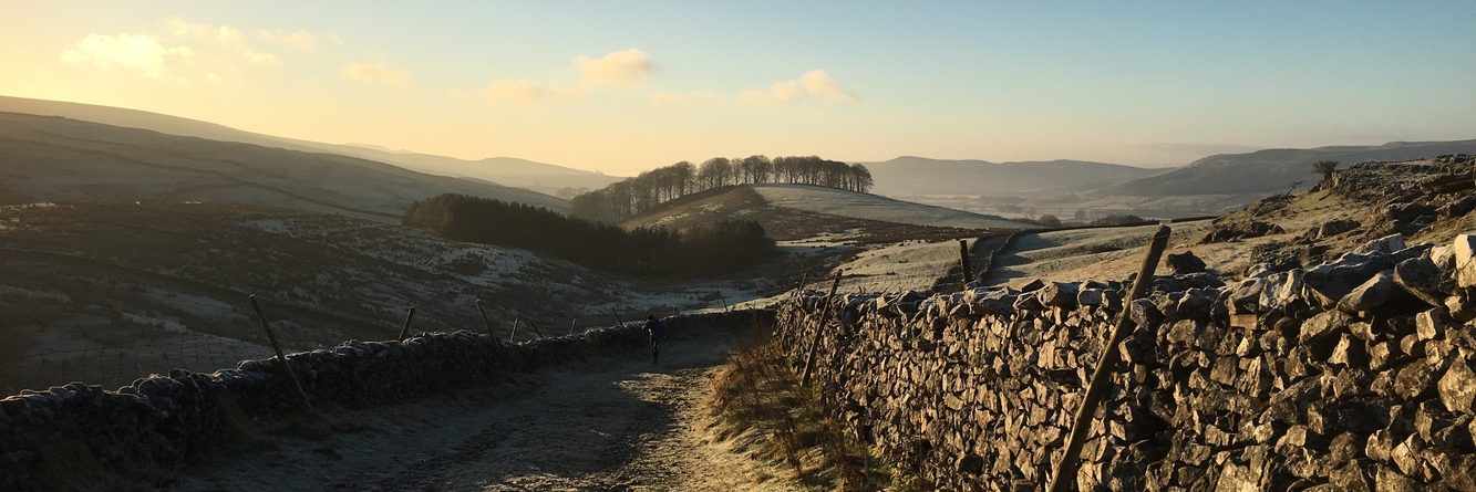
Much of my January mileage was on my local trails, keeping away from anything too lumpy for fear of upsetting the foot. This isn’t ideal given the ultra has it’s fair share of bumps in it. About 5500ft of bumps in fact. But the plan is to get to the start line as fit as I can be and as injury free as possible. It’ll be slow and measured with a view to get around intact and to hopefully enjoy it. Trail ultra-running is my happy place, after all.
Visiting Kearsley
Having had a day free last week I planned a trip over towards Bolton where I’m originally from. Looking at the map there seemed to be a few trails around the area and it was an excuse to go back and visit to see what, if anything, I remembered. We’re talking well over 40 years ago so I wasn’t expecting miracles, but there was a hope that it would connect a few dots in some dark part of my memory that hadn’t been accessed in all that time.
Getting to Kearsley was easy from Stockport, although the 20-ish mile trip actually took an hour by train. I guess it was faster than walking…….
Knowing that there was going to be plenty of tarmac involved, I took a risky decision to go with my road shoes. The weather recently hasn’t been too wet, in fact the last few days the ground has been frozen solid. But by the day, things had thawed a little and there was a risk of cartoon-like skidding of feet if there was any sign of mud. And that was a given!
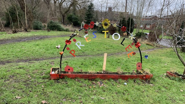
I took a little bit of time to orientate myself coming out of the station to ensure I headed into, rather than away from the Kearsley area. The town is made up of a number of smaller entities and the first part of my route was to circumnavigate Stoneclough, the “entity” I’ve always labelled as from where I hail. But as it turned out, I actually grew up in Prestolee, which is just on the other side of the River Irwell.
Prestolee sign
In terms of a town, well there didn’t seem to be much to either conurbation; a few pubs, a chippie and a local shop on a street corner! Kearsley itself is further south and I presume contains a few more town-like shops. And of course Farnworth is a few minutes up the road and is slightly larger too. Keep going north and you end up in Bolton which is the main centre.
I headed through Prestolee looking for the road I grew up in. Prestolee is tiny so it didn’t take long to find. I have a fleeting memory of being on a tricycle pedalling across the road from our house to another almost opposite; I presume we knew the people there although no details were in my memory. I remember my mother being a bit panicked as a car was coming. Looking at the bend in the road today, it’s tiny. And the road was a dead-end about 15 metres beyond the bend so nothing could be going fast in reality. Yet my memory was something of a vast crossing of a busy road full of dangers. How different our perceptions can be with age.
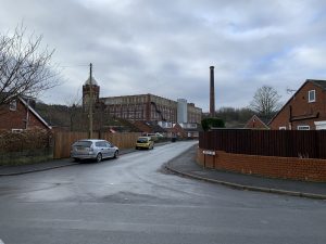
Kearsley Mill
Hazy memories
There wasn’t a lot to do there, and it would just be weird to knock on the old house and tell the occupant I lived there 50ish years ago. I have no memory of the inside of the house other than the lounge had a fire that my father and grandfather had installed.
My only other accessible memory was that there was a track around the back of the house that led to a farm and a bridge. The memory was that it was right next to the old house, but the reality was I had to leave our old road, turn onto the next one and then follow it; my brain clearly having edited out those details. Similarly the houses that lined the road had clearly been there longer than those on my old road, yet the brain had edited them out too.
Heading up the lane was confusing. I came to a farm that blocked the road as far as I could see. And there was no bridge? But the route continued as a muddy trail. And where there’s a trail, there’s a way! The bridge was forgotten as I followed the mud to see where it went.
The first notable was coming down to a strange collection of bridges, although the only one that looked nice was the one I couldn’t get an angle on to get a decent photo. So instead here’s a photo of the other two.
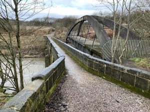
Too many bridges
Titter Ye Not!
Crossing the bridge took me to the edge of “Nob End Nature Reserve SSSI”. Yes, you can have a little giggle if you want. My plan was to keep heading forward to reach Moses Gate Country Park. Not that I had any memory of it.
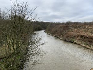
River Irwell
Nor did it stir anything when I got there. But the woodland approach was lovely and there seemed to be trails heading in all directions, many of which weren’t on the google map that I was checking against (nor on the OS map either looking now). In the end I took a left to cross the river to be on its west side where I found a trio of lakes with an insane amount of bird-life present.
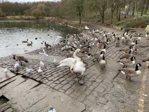
Birds at the lake
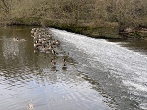
Birds on Weir
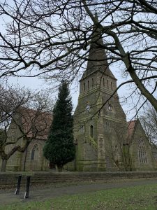
I looped around the water and headed uphill towards Farnworth Cemetery. There were paths that took me around the outer edge and ultimately heading downhill towards the river again on a path that seemed to be take me back from whence I came. I wasn’t ready to go straight back to picked up the road past the cemetery to find another wider running trail. As I headed up the road I could see Farnworth church on the hill and went up to have a look; I’ve actually rung a peal there, many years ago!
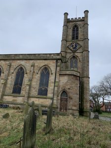
Farnworth church
Fail on the trail!
Retracing my steps back past the metrolink (tram) station I picked up my chosen path which cut straight across Nob End Nature Reserve to bring me back to the path next to all the bridges from earlier. It was a nice loop but I’d only done about 5 miles and definitely wanted more, so out came the map and I headed up the hill. Until I reached a field that was definitely going to be knee-deep mud. Given I was a) in road shoes, b) had to get on a train and c) then had to drive my car home, I wasn’t feeling the desire to embrace that amount of mud, especially as I’d probably end up face up or face down in it at some point!
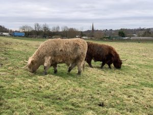
Cattle
So I decided to retrace further and pick up the road which linked up to where that footpath would emerge. Further and and less exciting. But on balance probably a better decision.
I returned to the farm and couldn’t see where the road went. I reached the houses where there was a minor road, I really wasn’t sure it was more than parking for the houses. yet it continued past. And as I came out the other side there was the hump back bridge that I had stored in a distant memory. At least that existed.
The “lost” canal
The bridge spans a canal (Bolton & Bury Canal) that doesn’t look like it’s seen any action in the last 50 years. I could have picked up the towpath but honestly, the state of the canal turned my stomach. Even tarmac was better than this alternative. So off up the hill I headed and away from town. I couldn’t believe quite how rural it suddenly was despite only being 5 minutes out of Prestolee itself.
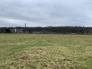
Kearsley at a distance
Onwards up the hill and past a couple of walkers who were sat on a bizarrely placed park bench (just at the edge of the road). I was enjoying myself, new places to run and things to see. The road reminded me of ‘Gun Lane’ above Marple Bridge in that it seemed to link two places for no obvious benefit and that it was practically a collection of pot-holes loosely held together with the memory of tarmac!
Back to Stoneclough
Eventually the road surfaced out at the main road north of Stoneclough and I turned right to drop down the hill back into the ‘village’. The plan had been to follow the road all the way back and repeat the section I started on, but thankfully a trail opened up before I got back to the river and it beckoned me to follow.
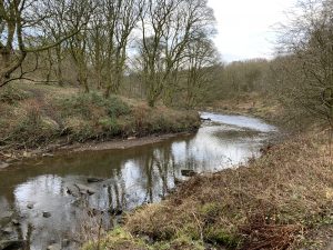
River Irwell
The trail ultimately turned into the canal towpath for the derelict canal I’d found earlier. It was clearly the start of the canal but judging by the debris in the water, no vessel could go through it. Not that it could go anywhere anyway given the canal just stops. I don’t think I’ve ever been to the start (or end?) of a canal before, but I presume they all must start and stop somewhere!
I could see Prestolee church up ahead and aimed at that, dropping down from the canal just behind it. The road itself was a dead end and whilst I did a loop to see if there was anything more of note, including a loop down to Kearsley Mill, it turned out to be a whole slew of dead-ends.
Prestolee church
Train fail!
I returned to the railway station a good 15 minutes before my train and found another trail that looped around. So having the time I followed it and found a nice vantage point over which I could look across Prestolee and to the nature reserves beyond it.
I got down to the platform in loads of time and jogged up and down it waiting for the train. What I didn’t realise was that the train i needed was going in the opposite direction; in fact it was the train I arrived on. So I watched it head off towards Bolton before realising I should have been on it, and then change in Bolton to head home, rather than the more obvious assumption of retracing my steps from the morning! Duh!
There was a train going back to Salford but it appeared that I would then have to wait another hour for the next Bolton train to come through. Instead I plotted a route across Salford and Manchester to intercept an earlier train assuming my cross-city navigation was up to the task. Thankfully it was and I go home only 20 minutes later than I would have done had I caught the right train in the first place!
So a nice trip out. I’d like to say one along memory lane, but the reality was that there were few memories to be stirred. I enjoyed it all the same and am already planning more trips over that way. Although I might drive next time!
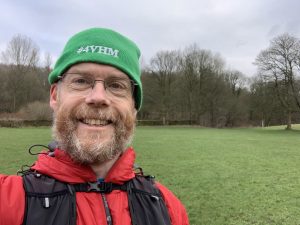
Me in Moses Gate Country Park
Final thoughts
I was a bit sad that the trip didn’t unlock any long distant memories but things became a bit clearer during a conversation with my mother shortly afterwards.
At the time, my father was working a reasonable drive away, and with having only the one car (normal at the time even if it isn’t now) this meant that my mother (when she wasn’t working) was stuck around home. And whilst the idea of running or walking 2-3 miles on the spur of the moment doesn’t make me give a second thought, the reality of doing this with a toddler and/or with pushchair is another thing. Sure, these days many runners have invested in off-road style running buggies for their little ones, but I don’t think these were a thing in the early 1970s. Nor were my parents into running.
So it would make sense that I wouldn’t have necessarily visited Moses Gate Country Park back in then. It appears from the conversation that my parents hadn’t done so either themselves so it’s quite likely that at some point, we will revisit the locality to see what memories the trip stirs for them!
We’re looking forward to revisiting the area. A lovely account of ‘your day out’ Simeon x