I’m conscious that most of my running-related posts have been reports on various races I’ve participated in. And given I did almost 30 races in 2018, there was a lot to write about.
Lessons learned from 2018
Whilst I did my first two official ultramarathons in 2018, I almost certainly didn’t do enough focussed training on them. So whilst I completed them, they were probably at a slower rate than I might have expected to have managed.
Whilst this might seem a little bit on the poor side, it was a conscious decision. Albeit a slightly dubious one! In previous years, I had done all the ‘right’ things in terms of marathon training, but had managed to get injured during that training.
Each year.
2018 was a conscious ‘foot off the pedal’ year. To go out and get back to enjoying running, rather than beating myself repeatedly with it. To that end I had a great year, taking part in a wide range of races, from 5k fell races all the way up to a 60k trail ultra.
It’s worth highlighting that although I wasn’t training per se, the fact that I was running regularly throughout the year meant that I had a reasonable base level of fitness. That enabled me to build up to the two ultras to some extent.
What I did discover however was that the training intensity and load relative to my food consumption was too low. The result being that I put on a stone in weight. This wasn’t a major problem when it came to the long distance stuff, but it did hurt my road half-marathon times. So that’s something to watch out for in the future if I drop my training load!
A bit about the Bullock Smithy Hike
I have an 18 week plan drafted to get me to the beginning of September when the second of the ultras, the Bullock Smithy Hike takes place. Yes, another odd decision on the surface, but the first ultra is only about 48k in length and about a month before the Bullock, so I’m planning on using that as a training run for the bigger event. Similar terrain but shorter.
So what is the Bullock Smithy Hike? Well first a bit of background; the village of Hazel Grove used to be called Bullock Smithy. Legend has it the place was a picture of debauchery, drunkenness and general naughtiness, so they ‘rebranded’ it.
If you ever happen to visit on a Friday night, you’ll see that little has changed.
Our local Scout troop take the old name in their title and for many years they’ve organised the Bullock Smithy Hike, a Long Distance Walking Association (LDWA) event. The route starts and ends at the scout hut in Hazel Grove, and takes the participants through 14 checkpoints and across 56 miles of the Peak District. They give a time limit of 24 hours to complete the loop which is long enough to walk the whole route, albeit at a decent pace.
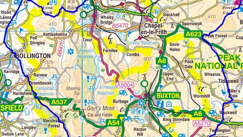
It looks a bit like this:
Bullock Smithy Hike map (as taken from the race organiser website)
Of course such an event attracts trail runners as well resulting in a course record of 8h46m and many times well inside of the 24 hour cut-off.
As a local event it’s been on my radar for a number of years, but has always been on the back burner due to other commitments. I’d planned on doing it in 2018 but signed up to the Gritstone Grind instead (usually the same weekend but they were a week apart last year).
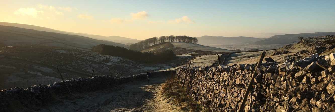
First section of the first recce!
Training
I’ve already mentioned that I’m working with an 18 week plan to (hopefully) have my fitness hardened enough to run 56 miles. As far as ultras go, it’s at the baby end, however it’s still the furthest I’ll have run in a race by a large margin.
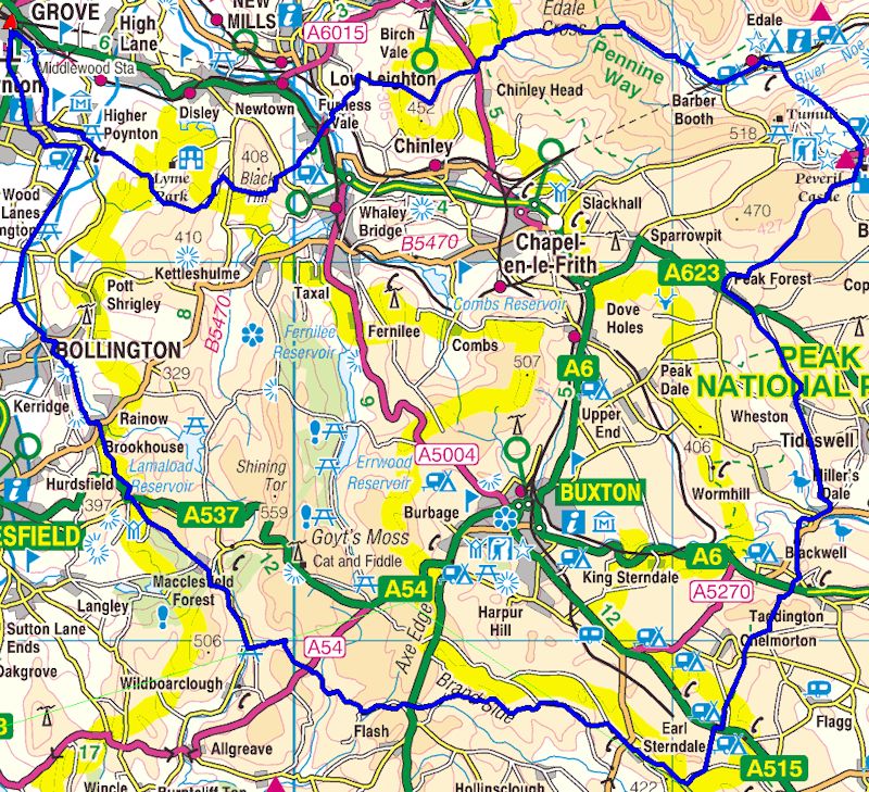
The other aspect, different from road races is navigation. This is something far more normal in the fell running world where the race aim is to reach various checkpoints – in the right order – but the actual route is up to the runner themselves. Now the organisers have given a ‘suggested/recommended route’ which is shown in the blue line above. But regardless of whether one follows that route, there’s no mile markers, nor marshals, except at the 14 checkpoints. The onus is on the runner to find their way around the route. And to be clear, this isn’t working your way around town or a housing estate; much of the route is in the hills away from town.
So part of the training is to actually recce the route and work out how best to get from checkpoint to checkpoint. Which are, for reference, shown below (with the approximate distances based on the suggested route):
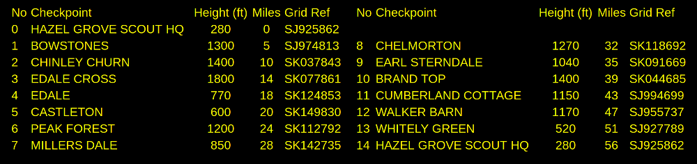
Bullock Smithy checkpoints
Recce 1: Hazel Grove to Edale
Having cleared off my road races of the spring I was keen to get out in the hills. I decided that the 18 miles from Hazel Grove to Edale would be a reasonable run out. I could get the train home after that so I wasn’t reliant on other people picking me up (or having to run back again). Aided in that I knew the route to Bowstones inside out and that I’ve run in the hills around Kinder a number of times during fell races there. Whilst being a route I didn’t know in its entirety it seemed like a relatively straightforward option to start with.
I’d been studying the route on my OS map and took this along with the guided instructions from the website. It’s worth noting that these ‘instructions’ might best be described as ‘memory aids for those that know the route but need the occasional prompt’. They’re very brief with a couple of sentences maximum describing 5 miles of open countryside. The need to get out and explore the route before race day is paramount.
Here’s the route I took:
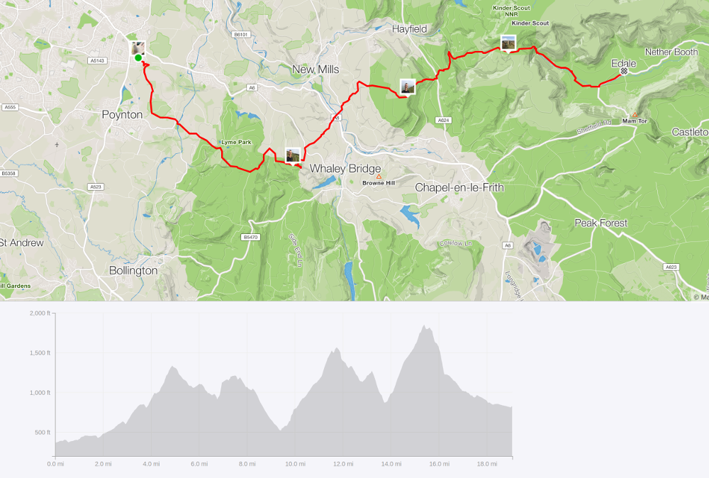
Bullock recce 1: Hazel Grove to Edale
I guess there a two stand-outs. Firstly, it’s quite a hilly start. 3800ft of ascent according to Strava, which isn’t a great surprise given the start of the route is in the low-lying Cheshire plain and it has to get up into the Peak District. Secondly, it was over 19 miles in length. Let’s just say I didn’t take the most direct of routes in a few places. Specifically on the climb up after Bowstones I managed to miss the path I wanted and had to go back to find it. In a similar navigation issue I was unable to find the path to cut-across the valley to get onto the rocky path leading up to Edale Cross.
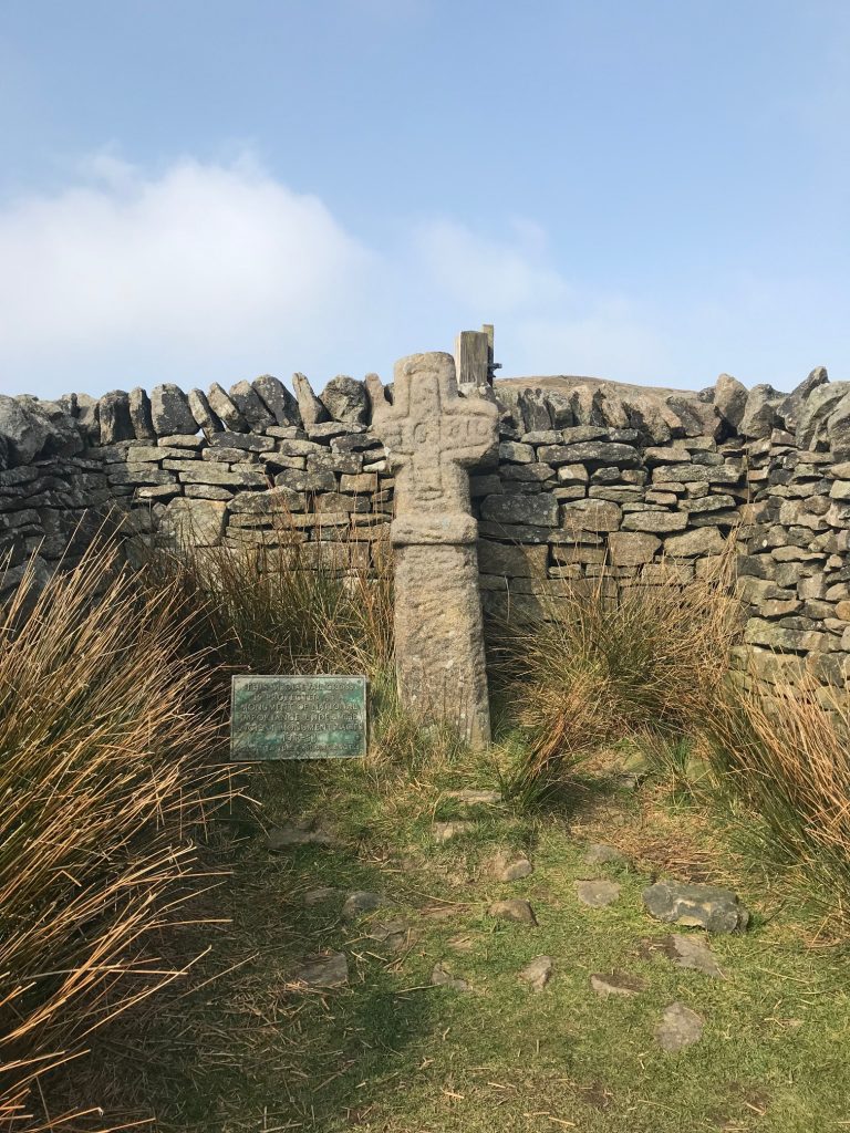
Edale Cross
And whilst the navigation on the next section was fine, I managed to fall flat-out on my way down from Jacob’s Ladder, leaving me with no water as my bottle exploded and a few cuts and bruises to remind me that I can’t fly. I subsequently missed a turning in Upper Booth which would have cut out a windy bit of road and thus a few more metres of travel.
In fairness, rather than having the map to hand I’d navigated more by a mixture of the ‘instructions’ and my knowledge of the area. In practice the map should have been in my hand, not in my bum bag!
I also just missed a train heading back, but every cloud has a silver lining. Finding a cafe next to the station where I could get my cuts cleaned up and a mug of coffee and a flapjack was a nice result.
The run wasn’t quite over as looking at the train times (and costs) getting back to Hazel Grove was a faff. So instead I travelled back to Marple and ran the 4 miles back home. It’s all training!
It did emphasise the importance of knowing the route ahead of race day. It was also a chance to trial out kit. I took my Christmas present OMM 6l bum bag with me for this. Size wise it was perfect. However, the drinks bottle holder was in a position where the bottle bounced into my hip every step which was definitely not what I wanted. As a result I carried that bottle around with me until my fall when it (plus contents) went flying across the trail!
Recce 2: Earl Sterndale to Hazel Grove (the last bit)
With Easter approaching there was a discussion within the wider running group about doing a Bullock Smithy recce. Having spent a lot of time trying to work out the map in the later section of the route I initially suggested this. However, the ‘nearest’ place we could get public transport to would result in a 23 mile run. Which was deemed a bit far for most of the group. So instead the group decision was do do a shorter part of the middle section.
I was a little disappointed that I wasn’t going to be able to get a ‘guided tour’ of the complicated bit. I’d spent a lot of time trying to work out the route on a map with more footpaths criss-crossing the square on the grid and it was as clear as mud. I studied a few Strava traces from people I knew who had run the route and whilst it gave me an idea, it wasn’t clear. With a relatively free Saturday (only a few hours work) it became increasingly obvious that I needed to get back out again and experience it for myself. So I did.
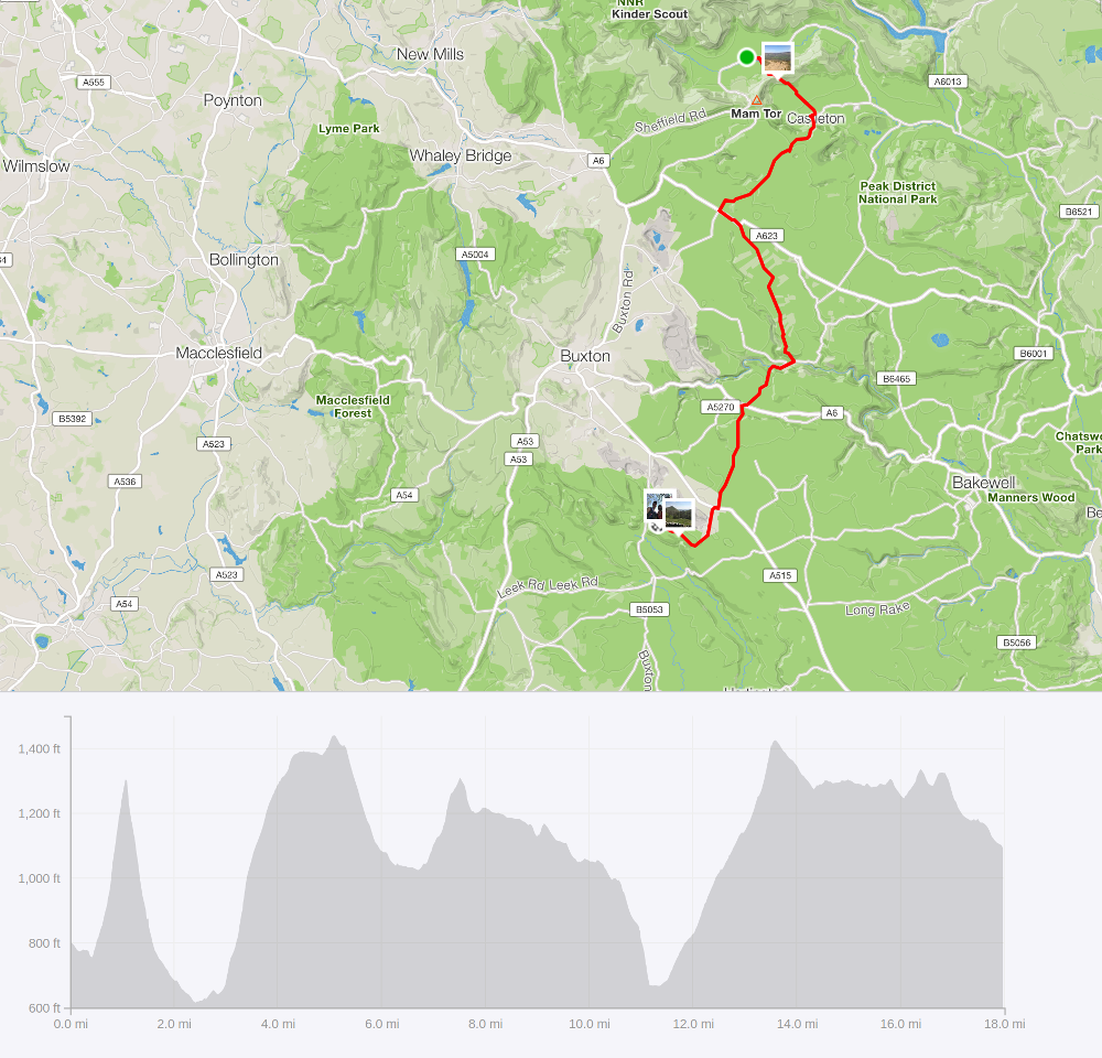
It was the opposite arrangement to recce #1. This time it was a matter of getting out to Earl Sterndale via train and then bus and then running back home. It looks something like this:
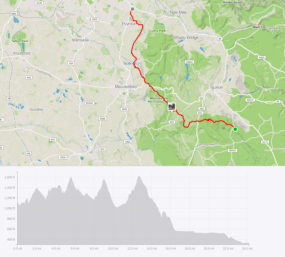
Recce 2: Earl Sterndale to Hazel Grove
I actually had it in my mind that this last section didn’t have much ascent, but that misconception was soon debunked with 2700ft of ascent recorded. So whilst less than in the first section, still plenty to be going on with!
The first test was getting to the start and that bit went ok. By midday I was stood in Earl Sterndale safe in the knowledge that the only way home I knew was on foot. Although when I said ‘I knew’ that was probably being a bit confident – I had a map which had my current position and my destination on it!!! It was a chilly day and I ended up wearing all my clothing rather than carrying it. Not quite the plan but there’s no point in freezing for no reason.
The start of the route was fine. But then there wasn’t much I could get wrong. It was when I was approaching Brand Top that I managed to lose my way on the map and spent a good 20 minutes bouncing around a field trying to work out where I was. From the map on my phone I knew I needed to be a little further across from this position and it did take me a while to fathom out how to do this. It was only as I passed a building that I realised I was even at the checkpoint, which meant that I was no longer in the place on the map that I thought I was. So a definite wake-up call that my navigation needs practice!
I pulled myself together, tried to work out what the route I should have taken was before heading off towards Knotbury where I managed to take a circuitous route having convinced myself I was on a different road to the one I was on. Oh well, that’s why we do recces!
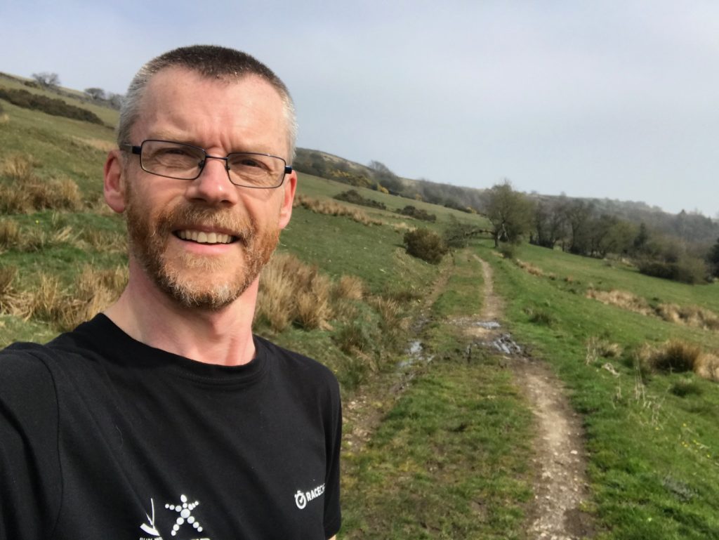
After leaving Cumberland Colttage
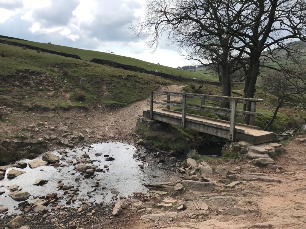
Once I’d finally found myself at Three Shires Head things began to settle down. Following the footpath resulted in one wet foot as I tried to work out where the stile to cross the main road was. But once over the navigation because much more straightforward. Cumberland Cottage was easily located and then it was a travel along a number of roads and bridleways through Macclesfield Forest and the onward to the canal near Bollington. At this point it was very much ‘home territory’ although the latter miles were on heavy legs!
Recce 3: The middle section from Edale to Earl Sterndale
When I started this post, I hadn’t anticipated that I would have done 3 recce runs in 3 weekends before I’d even published anything. Nor would I have recce’d the whole route. But with good weather and a relatively free diary, that’s just how it worked out.
Having had the original plan of a group run on the last section not happen, instead we settled on part of the middle section. The plan being to run 6 miles of it from Edale to Peak Forest before returning to Edale. At the last minute one of the group announced they had space in a return car journey from Earl Sterndale. The net result was the opportunity to do all of the remaining section of the race route (roughly 17 miles and 2700ft of ascent).
Recce 3: Edale to Earl Sterndale
Having a large group to begin with made the initial navigation interesting. Mostly because I was following others rather than having to work it out myself. So it was straightforward but about halfway up Hollins Cross I was aware that I needed to be more engaged in the navigation; I’ll most likely be on my own on race day so need to awake! This short sharp hill, followed by a trip through Castleton and out via Cave Dale were the toughest sections under foot, with a lot of climb on stony ground.
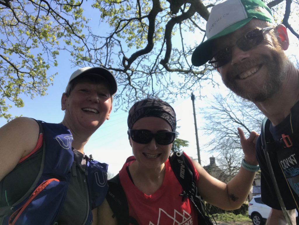
The Earl Sterndale 3!
Once at Peak Forest the group split with most heading for home and three of us continuing south-ish for another 11 or so miles. And this time I was thinking about the navigation although it was seemingly a lot more straightforward. Long (very) sections of bridleways plus a couple of road sections. At the end of the longer one we ended up giving directions to a group of lost Greek tourists trying to hire bikes; not sure where they had come from as we were in the middle of nowhere, although we managed to point them in a likely direction of both bikes and a trail to ride them on.
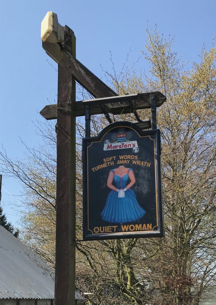
We eventually dropped into Earl Sterndale, a tiny hamlet with a lot going on! It was significantly warmer today than when I started from here last weekend and the pub was very busy. So whilst we waited for our lift to arrive we watched the world go by on bikes, in cars and in chicken form.
So what now?
With any big event that isn’t signed to within an inch of its existence, it’s important to be confident in the navigation. And whilst there’s a lot of room for improvement, on the whole I feel I’ve progressed well on this. I know a couple of areas which are a bit suspect but on the whole it’s not as scary now as I had imagined it to be.
There is still the element that is fitness. Each recce has been exhausting in its own right. But on race day I get to run them all back to back (albeit not in the order that I did the recces!). As such I need to build up the fitness to be able to cope with that. There’s plenty of time for this; most of the training will be shorter distances and at a nice slow pace to build that huge aerobic engine required for the job. But there will be plenty of long routes out, hopefully in the Peak District just to get the relevant miles in my legs, and to get used to navigation whilst running. It’s learning new skills and improving upon others. And if the weather continues to be decent, that should be an enjoyable experience!
Be the first to comment on "Ultramarathon training – it begins (sort of)"